Monday, August 13, 2012

Cle Elum

We arrived here yesterday in time to set up, get in and turn up the air. The 90's in mid afternoon are really hotter than we have become accustomed to.

Today we hit the path early. We were on our bikes about 8:30 for a ride on the John Wayne Pioneer Trail. Our park is a short drive through the neighborhood and a stair climb (Russell carried my bike up for me!) to the Rails-To-Trails path. This one follows the Yakima River, just south but out of sight of I-90. The trail itself is not paved, but hard packed dirt and gravel. We really had to watch the road to avoid deep loose gravel and larger rocks. The route to Cle Elum is pretty with lots of trees lining the way. We got to the train depot - really - and took the surface roads to town for a cup of coffee. We found a great local place and met Red Dog, a very nice local who gave us a lot of good info and insights. We got back home for a total of about 10 miles, ready for lunch.
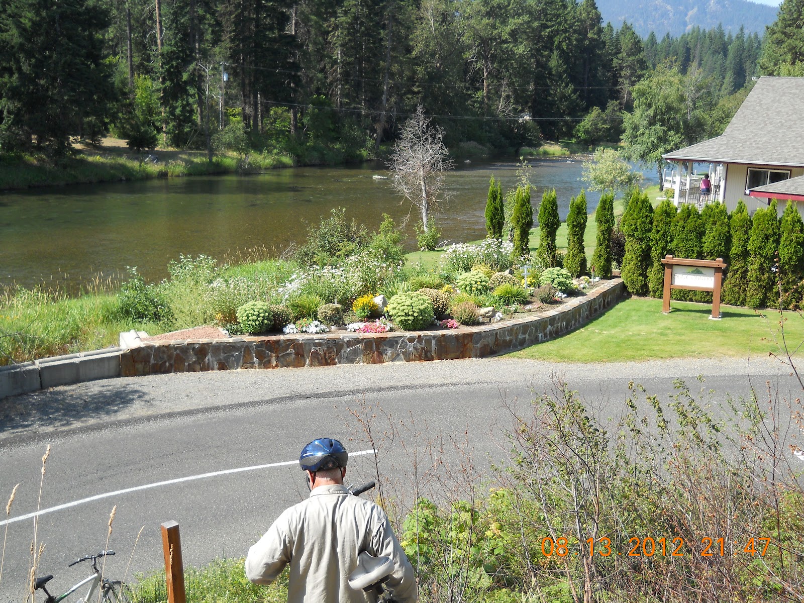
This afternoon we drove to the nearest Walmart in Wenatchee. Several people told us that it is a pretty trip across the pass through the Cascade Mts. We headed back east and then north on a very busy mostly 2-lane state highway to the Apple Capital of the USA, if not the world. The Wenatchee area really reminded us of California; arid hillsides, lush orchards with irrigation. We enjoyed a stop at a local fruit stand. You could see most of the food growing within sight of the stand, except the onions which are from Walla Walla.


The drive back was not as busy, but just as pretty. As we neared flat farm land Russell noticed a smoke cloud obscuring an otherwise blue sky. As we got closer, the flames were evident on the south side of the ridge just south of the freeway. This appears to be a large fire, but we have no reports as yet. It does look like our park is well west of the affected area and will remain out of range.

Sunday, August 12, 2012

I-90 in Eastern Washington State


“I don’t know what we are looking at, but it is really beautiful!”
“It’s some water.”

 You will have to guess which of us said what, but that shouldn’t be a trick!

 We have just stopped at a rest area on the eastern side of Washington state, same one we hit 3 years ago when passing this way. I was thinking about blogging and decided that I could do it now and transfer to online later. We will stop in about 150 miles for a few days in central state.

We are entering the farming section of the state. It has wider expanses of pasture land and more than just hay type grasses in cultivation. The fields have been beautiful with a variety of greens and yellow-tan colors depending on the level of irrigation and rainfall. The predominate color is what I have decided to call DRY. It is sort of golden. At some places the farmers are working at bailing. Is the grass ripe or just tired? It is full and the corn is really pretty, not like the shrunken variety we drove past in the drought stricken corn belt.

 Some nice things about traveling in a motorhome: With the generator on, I am free to blog, and I can go make lunch so the chicken salad will be ready at the next rest stop! Very Cool!

 Back on the road and we ate too soon. Just past our stop is the fabulous river view I remember from our previous trip in 2009. You are driving along these wide, barren, rolling hills when you start to get glimpses of a massive river. As you near the bridge, there is a Scenic Overlook area to gape and stare at the gorge made by the Columbia River as it flows from the north and makes a turn west. We kept going, but I took as many pics as possible along the way. We were barreling down this 6% grade, curving toward this bridge with traffic on all sides. I’m all over the cab trying to get the very best on-the-move photo when here comes a Model T (yellow), 2 motorcycles and a camper on the on-ramp. Good news! I got the picture!


We entered another farming region, and a number of Vegetable Stands that looked really great from I-90. We were starting to glimpse snow-capped mountains between the ridges closer at hand. Then all of the traffic began to slow as we saw smoke ahead. Firemen were on the shoulder fighting the grass fire before it got to the trees. Fire in the median was being allowed to burn as long as it didn’t get any wilder than it was. We exited at the next town and saw more trucks on their way to the blazes. It was no surprise to see the FIRE BAN sign as we neared the RV park.

Trail of the Coeur d’Alene’s


After a couple of not-totally-successful tries on the Centennial Trail, I talked to a lady working at the campground who recommended another trail, a way better one. We drove about 20m east on I-90 and headed south to the Bull Run Trailhead. She assured me that we would see more animals than people. From the looks of the parking lot, word has spread since her last trip out there.  This trailhead is at mile 33 of about 60, so we had a choice and decided to head east to the town of Cataldo, a 16m round trip.

 A quick trip to the potty and reading the sign there revealed that there are 36 species of pine trees on the continent. More reading would probably have told me how many we would see on the trail, but I didn’t hang around that long. Anyway, I had a mindset for the ride. The first I noticed were the long needle type. There were several short needle types; I say several because the branch patterns varied. My favorites were the ones that look more like fern branches hanging off of pine trunks. They are wide lacy branches that lay delicately on top of one another. Names of these different types would only cloud my scanty knowledge!


But there was more to see! We biked along farm fields, lava rock mountains, deciduous trees of all types, lakes, marshes, and a river that beautifully reflected all of it. We stopped at the Mission Café for a great lunch (Russell a hamburger, me a turkey-cream cheese-cranberry sandwich). And then hit the trail back to the car. It was just a pretty going west.


Day 2:

We headed directly south out of the park down US 95 to the town of Plummer and then east to Heyburn State Park. Looking more at the map, Russell decided to not bike that section which travels a bridge over a narrow section of Coeur d’Alene Lake and then up the shore line to Harrison. We would drive to the town of Harrison instead.  Now the trail, set out by the train company roughly a century ago, is a distance of less than 15 miles. The state road, connecting several towns along the way, is closer to 30 miles of sheer beauty! We stopped to see where the St. Joe River flows between 2 lakes that it separates. Weird to see the river flow between 2 still bodies of water. The St. Joe is the highest navigable river on the continent-a little known fact.


Harrison is definitely a river town. All activity centers on the river and the bike trail that runs along the river. It is a pretty town of bike shop, bars, ice cream shop, and houses on the bluff above a very busy marina and river below. We headed west from mile 15 towards the Bull Run Trailhead of the previous day. This section of the path is even more populated with bikers and walkers. It is also even more beautiful. Marshes are full of birds, lily pads of different types, cattails and other marsh grasses. A chain of lakes is connected by the Coeur d’Alene River. Evidence of the timber business glory days is sprinkled in and still active, but only in a limited way.

We rode north for roughly 4m, then back to town for lunch. We set out toward the bridge to the south to see how far we could get. Riding, you can usually hear a biker coming up to pass, they often say, "On your left." I heard conversation coming from behind and expected the usual, but instead just heard very quick peddling coming around. This boy, on the smallest bike I have ever seen without training wheels, was totally focused on passing me, which he did in grand style. He may have been 4, certainly not 5 yet. I felt very old. Very slow. Totally outclassed. The boy's father had a slower pace, but passed me all the same, congratulating the son on his good job. Precious. Mom caught up later with 2 toddlers in a carrier. A neat family outing.

We got within sight of the bridge, called it done and headed back. Another 4m out and then back. On the return trip I saw the shadow of a fairly large bird coming up from behind. A soaring hawk swooped down ahead before landing in the tall branches of a pine. We also spotted several nesting osprey. The smaller birds I can't name, but they certainly add to the music of the trip.

Now when I cite the mileage on our trips, I am talking about the miles that I traveled, give or take. Russell logged way more than that because he would get a significant distance ahead and then come back to see how I was doing. Sometimes, he went ahead when I turned back, and of course he beat me back to the start. He didn't go twice the miles, maybe half again. He got more exercise. I took more pictures and had all the exercise I could handle.


We are taking advantage of the rails that connected these logging centers via the Rails-to-Trails program. They carved out the mountains to create the most direct, flattest route possible. We all thank them, mostly. Signs along the trail warn bikers to not get off the path to respect private property. A longer version sign warns that the soil may still be contaminated with lead and other harmful matter. The trail and associated Wayside stations are the only safe locations. They warn to carry hand sanitizer and use it liberally prior to eating and to not sit on the ground or place food on the ground. Interesting.

Wednesday, August 8, 2012

Bike Rides

Any time the conversation turns to fabulous bike rides, Russell will get a glazed far-away look as he describes the Hiawatha Trail. Well, yesterday he got another run at it and fell in love all over again. I did not feel like I could handle the full 14m trip, even though it is down hill. And there is no way I am going back through the 2m tunnel that begins and ends the trip.  The remainder of the trip is fully worth it, however, as I have been hearing for the last 24 hours.

The trip is a rails-to-trails project that follows the original Hiawatha Train path. It crosses trestles that soar over the river below so that you are on eye level with some tree tops and looking down on most. There are a total of 7 tunnels, most of them short and only 1 monster. I uploaded some pics from previous trip in '09.

Today we both traveled parts of the Centennial Trail. This is a path that stretches 24m across the Idaho panhandle, mostly along I-90. It also winds through the small towns along the way. This morning we drove west to Post Falls to ride the last 5m from there to the Washington border. Actually, construction near the border stopped us a mile or so short of the goal but the return miles were just as pretty headed back east.

A short shopping trip, lunch (Huckleberry Shakes), and a drive back to Coeur d'Alene and we were good for a few more miles. We picked up the trail on Lake CDA for a beautiful ride along the shoreline. I gave out as the road began to rise fairly steeply(my assessment) into the hills east of town. We were not alone on this cool, overcast day. several groups of bikers, runners, kids, and families enjoyed the track. On the lake boaters, skiers, and a parasailer added to the scenery.


A good day all around. Look forward to more tomorrow.

Monday, August 6, 2012

McGregor Lake, MT

Russell has been fascinated by the small town of Libby, MT for several years. It is in the most northwestern county of the state. We heard about the great fishing in an area between Libby and Kalispell, a chain of many small lakes, creeks and the Kootenai River. We also were told about a nice RV park. All rumors were proved correct.

We spent several days at Lake McGregor Lodge, scenically located between Lake McGregor and Little Lake McGregor, a short walk to each. A short drive on US2 takes you to the Thompson Chain of Lakes and the Fisher River. We fished, dodged deer, picnicked, and caught nothing but a few rays and some more mosquito bites. We also enjoyed the lodge owners and their restaurant. The restaurant-store-bar-casino is typical of lake hangouts whether on Lake McGregor or Texhoma.

We drove to Libby several times to look around and shop at the Town of Eagles. It's cool to see the nests on phone poles in town with mature and baby eagles. The sculpted metal birds were much easier to photograph.

Yesterday we left Montana after the better part of a month. We are now in Coeur d'Alene, again. We are now at the Blackwell Island RV Park. Coeur d'Alene is southwest of Libby, barely 100 miles between them. The trip between the 2 cities is over 200m first northwest, then south. The Bitterroot and Cabinet Mountains line the Mountana-Idaho border. What a great use of 5 hours.

Photos are on the new phone. will post after I figure out HOW!

Western Montana

Our stay in Coram included several evening drives through Glacier Park in search of WILD GAME! The closest we got were the vast herds of mosquitoes that attacked us on each and every outing. The crowds and construction discouraged us from a return trip to Logan's Pass until Sunday evening, when we correctly figured that at least the construction would be on hold. The traffic was also at a minimum. My goal was to hike the 1.5m path from Logan's Pass to Hidden Lake. This is a paved track that winds through an alpine pasture of low grass and shrub, wild flowers, small water falls and pools of marsh. With the setting sun casting a variety of shadows and colors from behind the mountain, it was a glorious walk, if a bit tiring on the mostly-uphill parts. We had to be getting close to the lake!  Russell said not even close, so I asked someone on the way down. He confirmed Russell's opinion of maybe a third of the way. I couldn't go any further and Russell wasn't all that interested. I mean where we were was fairly amazing.

Heading down hill we saw 2 beaver looking animals identified as marmots. Don't guess we have seen that animal before. We approached a very excited parking lot. Big horn rams were roaming between cars to lap up the water. I swear there was plenty of nicer water all over the place, but they seemed to like the extra mineral content of asphalt. We also got a wonderful look at the long-haired mountain goats grazing in one of the pastures.

A day hike produced a bumper crop of huckleberries, gathered up in the 2 water bottles we were carrying.  We picnicked, and relaxed by McDonald Lake. Sunset at the lake with mist rolling in was another terrific evening. We also had time for cooking out and enjoying the RV park.


I guess that putting some distance between the events and the blog is that only the brief summary remains, not a blow-by-blow account.